


details:
Title: Niersradwanderweg
Distance: 117 km
Inclination: partly hilly, partly flat
Surface: asphalt
Distance: 117 km
Inclination: partly hilly, partly flat
Surface: asphalt
Information
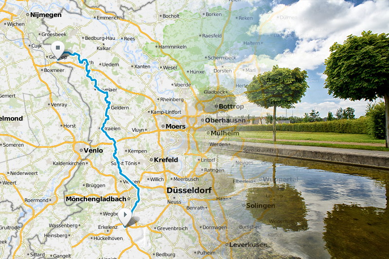
 The Niers Cycle Trail is an attractive route for an excursion of at least one and up to several days. It starts in Mönchengladbach and continues along the River Niers through the Niederrhein districts of Viersen and Kleve. The tour comes to an end at the mouth of the river Maas at Gennep in the Netherlands. In addition to the attractive scenery characterised by the typical meadows, fields and grasslands of the Niederrhein, cyclists have the opportunity to admire the changes to the riverbed.
They take place in a natural way as a result of the Niersauen concept which was launched in 1990. Away from all the urban development, this is a leisurely route to experience the natural environment of the Niederrhein in its typical and original state.
Download GPS-Track